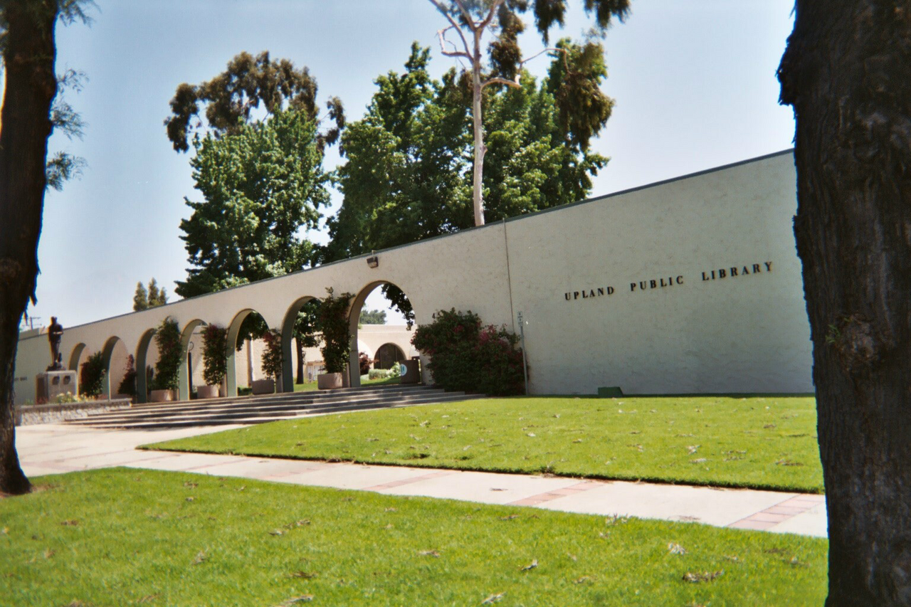
Upland City Hall and public library in the downtown civic area
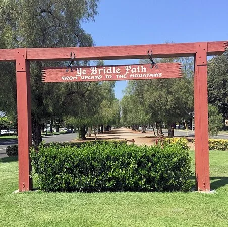
The landmark Ye Bridle Path entrance along Euclid Avenue
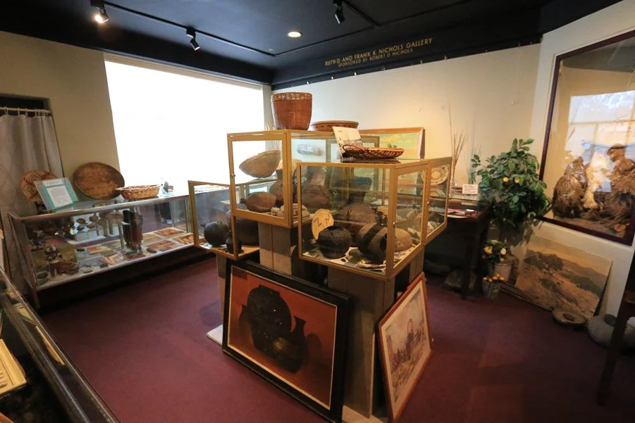
Local-history exhibits inside the Cooper Regional History Museum
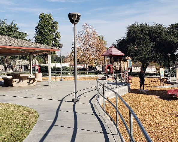
Playground and picnic facilities at San Antonio Park in Upland
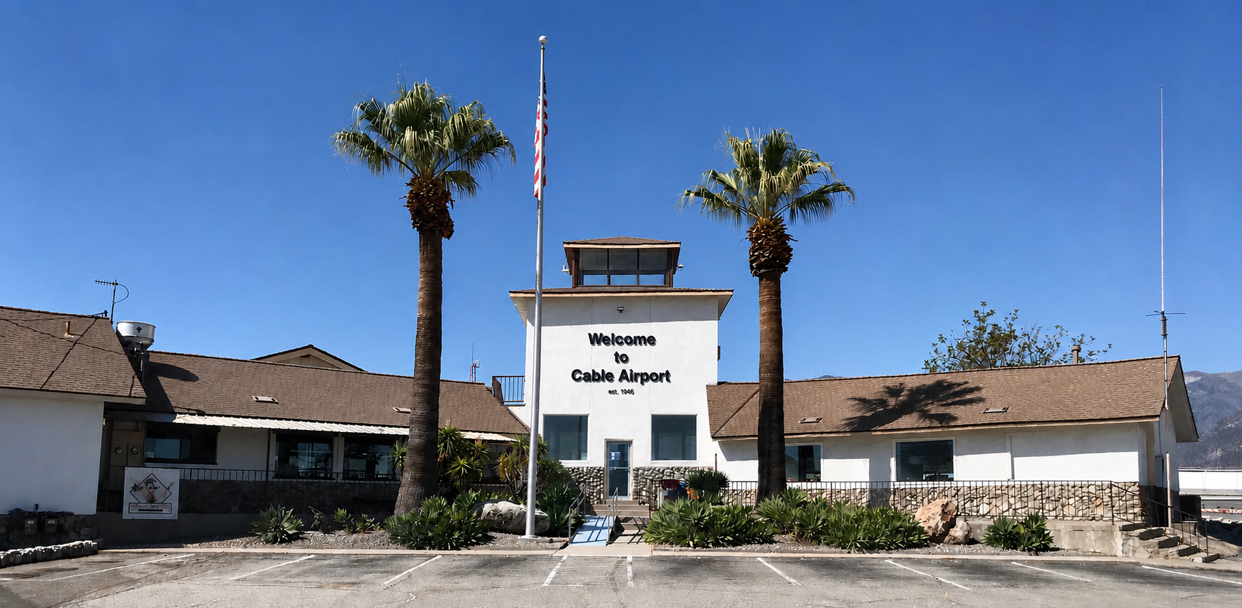
The entrance to Cable Airport in Upland
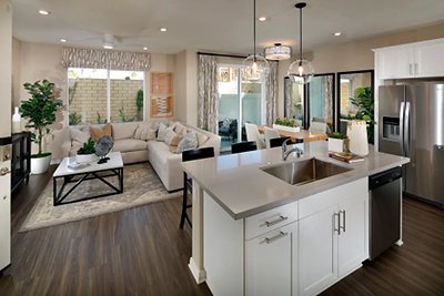
Rose Glen model-home interior—furnishings shown for illustration
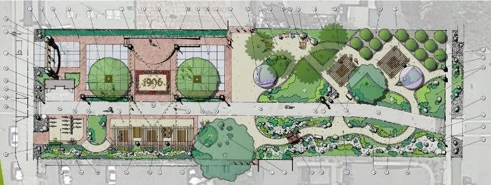
Magnolia Plaza planning illustration—not a photograph of completed construction
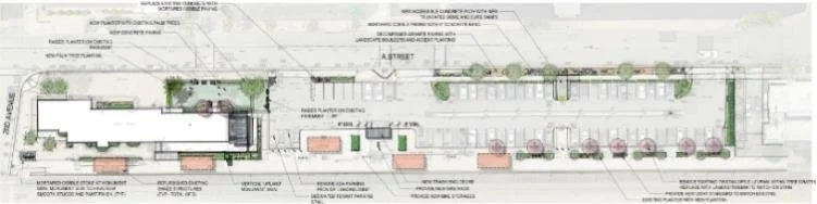
Santa Fe Depot rehabilitation site-plan illustration—design subject to change
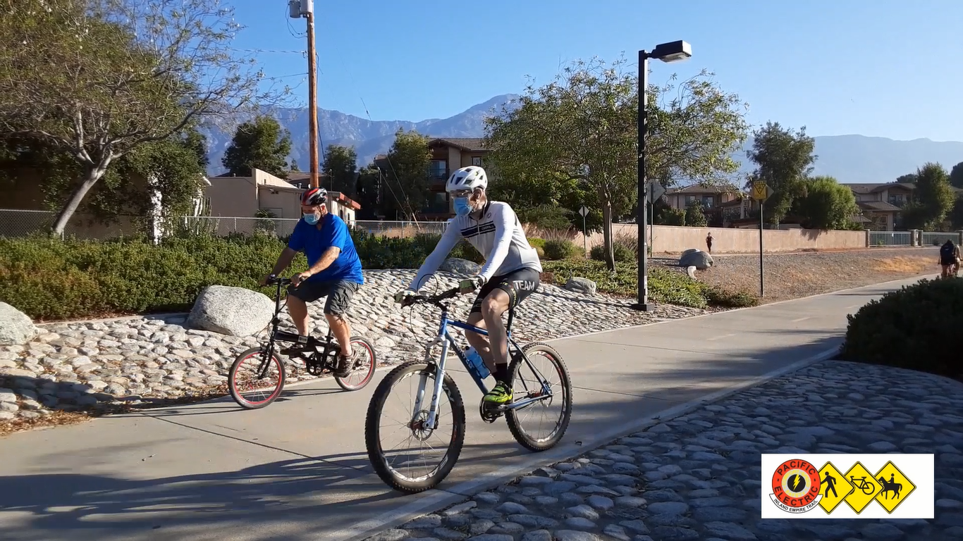
Cyclists on the Pacific Electric Inland Empire Trail in Upland
1 / 9
LOCAL KNOWLEDGE. A STRONGER HOME STORY.
Historic Character. Everyday Connections. New Possibilities.
Upland combines a recognizable downtown, treasured landmarks and neighborhood recreation with new housing and investment in community spaces. Explore the destinations that shape life here today—and the projects helping write its next chapter.
Established shopping, dining & community destination
Historic Downtown Upland
Historic Downtown gives Upland a gathering place with a personality all its own. Local shopping, dining and community events bring people into a district shaped by the city’s early commercial history. The Saturday farmers market and craft faire, along with outdoor dining and entertainment events, create opportunities to enjoy the area throughout the year.
The city continues to invest in downtown infrastructure and recruit businesses and housing opportunities. For homeowners, that combination of established character and ongoing attention to the public realm helps tell a compelling location story: a community with a recognizable center, local traditions and places to connect close to home. Check the downtown calendar for current event dates.
Euclid Avenue is one of Upland’s most recognizable addresses, with a landscaped central parkway and a history closely tied to the development of the surrounding community. The familiar Ye Bridle Path gateway marks a distinctive part of that landscape, where the setting encourages a slower pace beneath established trees.
Euclid Avenue is listed on the National Register of Historic Places, and the city’s surrounding historic districts reflect a range of early architectural styles. Together, the avenue, parkway and neighborhood streets give Upland a sense of place that is difficult to reproduce in a newly built community. For a nearby home, this historic setting is an appealing part of its identity, alongside the property’s individual features.
The Pacific Electric Inland Empire Trail brings an active outdoor connection through Upland and into the wider region. Following a former Pacific Electric Railway corridor, the multi-use route links Upland with Rancho Cucamonga, Fontana and Rialto, offering a setting for walking, running and cycling away from the flow of road traffic. Street crossings remain part of the route.
In Upland, the trail connects with the downtown area and adds another way to enjoy the community, whether the plan is a morning walk, a recreational ride or a stop near local businesses. Its combination of railway heritage and everyday recreation complements the city’s historic character. Nearby homeowners can point to the trail as a tangible lifestyle amenity, with access points, permitted uses and current conditions to be checked for each segment.
The Cooper Regional History Museum adds depth to the story of Upland and its neighboring communities. Located on East A Street, it preserves the region’s cultural heritage through exhibits, historic photographs and artifacts connected with local life, transportation and the citrus industry. Its collections help explain how the area grew from agricultural roots into the communities residents know today.
The museum also maintains a historic church property and supports educational experiences and community programming. For residents who value architecture, local history and a connection to place, this is a distinctive cultural resource close to downtown. Exhibits and visitor arrangements can change, so the museum’s website is the best place to check before planning a visit.
At Mountain Avenue and 24th Street, San Antonio Park brings everyday recreation into Upland’s northern neighborhoods. Ball fields, a playground, picnic tables, barbecues and a picnic shelter provide a mix of active and relaxed outdoor options, whether the plan is a casual afternoon outside or a reserved gathering.
The park also connects recreation with local heritage through the historic Ontario & San Antonio Heights Railroad Company Waiting Station, which features a small museum and mural. That combination of outdoor space and community history makes the park more than a place on a map—it is part of the setting that gives nearby neighborhoods their character. Reservations and facility access follow city policies.
Existing aviation landmark · event center proposal under review
Cable Airport & a Proposed Event Center
Cable Airport is a distinctive part of Upland’s identity. Founded in 1945 by Dewey and Maude Cable, the family-owned, public-use airport remains a center for general aviation, with businesses supporting aircraft services and the local flying community. It offers a different kind of connection to Southern California’s aviation heritage than the region’s large commercial airports.
A proposed airport event center would add a hangar-based gathering space and aviation museum, with accompanying retail and office space. The city’s October 2026 report lists the proposal as under entitlement review. It is a project to follow, with approval, final design and timing still to be determined. The photograph shows the existing airport entrance.
The entrance to Cable Airport in Upland Cable Airport
Recent residential development · additional projects progressing
Rose Glen & Upland’s Evolving Housing Choices
Upland’s housing story includes contemporary communities as well as established neighborhoods. Century Communities introduced Rose Glen near Arrow Highway and Grove Avenue as a gated collection of two-story, detached condominium homes with all-electric systems. The community illustrates how newer floor plans and lower-maintenance living can broaden the choices available within the city.
Other residential investment is progressing as well. The city reports earthwork underway at Villa Serena, an approved 65-home detached residential project, while construction plans remain under review. These communities offer useful context for both buyers and sellers evaluating Upland’s changing housing mix. Current availability, specifications, association costs and project schedules should be confirmed for the specific home; the model photograph does not represent every property.
Tom Thomas Magnolia Plaza is a new downtown gathering space taking shape beside the Pacific Electric Trail, between Second and Third avenues. The city’s October 2026 report lists the urban plaza as under construction.
The project adds another public-space investment to downtown’s evolving story. Its trail-side location brings a community gathering concept into the same setting as walking, cycling and nearby businesses. The illustration shows the planned layout; it should not be read as a photograph of an open, completed plaza. Final features and opening information should be checked with the city as work progresses.
The Santa Fe Depot rehabilitation initiative focuses on renewing an important downtown landmark. Proposed work includes repainting, a covered patio, landscaping, bicycle storage, lighting and parking-area improvements. The city’s October 2026 report records public design workshops held earlier in the year.
The goal is to make the depot setting more welcoming while retaining its historic identity. For Upland, the initiative reflects a broader opportunity to connect heritage with the way residents use downtown today. This remains a project in development; the site-plan illustration represents design work, and final improvements and construction timing may change.
Community information reviewed October 27, 2026. Project status reflects the city’s October 2026 development report where noted. Proposed plans, schedules, availability and amenities may change. Planning illustrations show proposed designs, not completed construction.
Photo credits appear beside each topic. Upland civic-area photograph by Rockero: CC BY-SA 3.0, displayed with proportional scaling. Model-home photographs and planning illustrations are labeled for context.